What with V for Victory and now W for Win it feels like there’s a certain vibe running through the blog at the moment, and the weather is splendid too.
This week’s walk was shorter than it might have been due to constraints on our time but non the less beautiful and with ample opportunities for extended versions offering a greater challenge should you care for it. ( further details included)
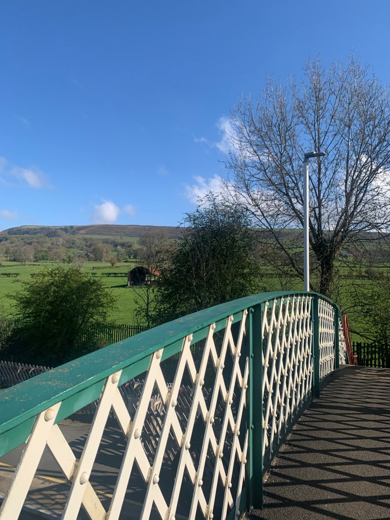
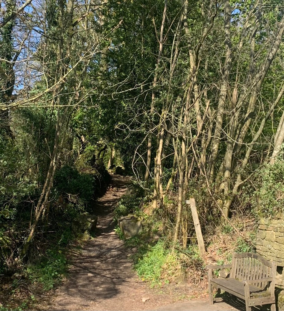
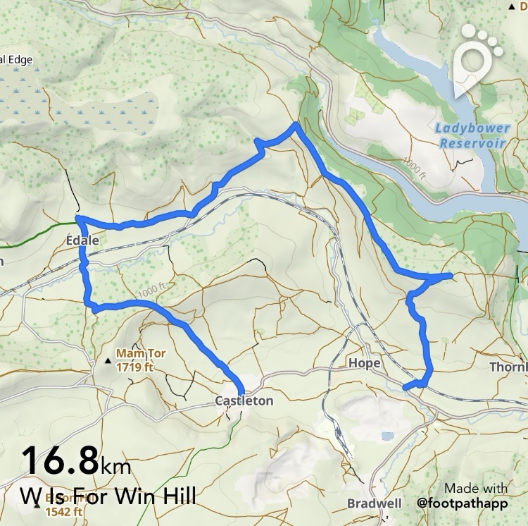
We begin by catching the 272 to Hope Station but obviously it’s also possible to arrive at the same starting point by train and we actually start our walk by going along the station platform and over the passenger bridge.
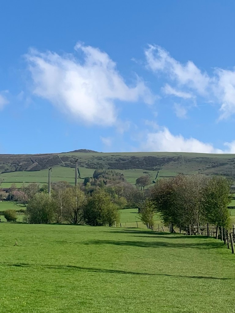
This plonks us onto a pleasant path up through the fields and with of Win Hill ahead of us already.
I’m sure most of you have been up Win Hill at some time or other and are probably aware that there are a number of paths to the summit. However for anyone who has only ever arrived at the top via Parkin Clough from Yorkshire Bridge, you will surely find our route today a nice change from slogging up that steep, unrelenting and generally muddy groove through the trees!
The field path passes through a few stiles before bringing us out onto Aston Lane at which point we turn left and then almost immediately right onto the interestingly named Free Range Lane.
We see no hens!…and although the lane is tarmacked we see no cars either.
We pass “King’s Haigh” an ancient looking property which apparently has historic links to the Eyre Family (who must be well known to readers of this blog by now) and then at Edge Farm we turn left onto a track known by the even more intriguing name of Ruin Edge Lane.
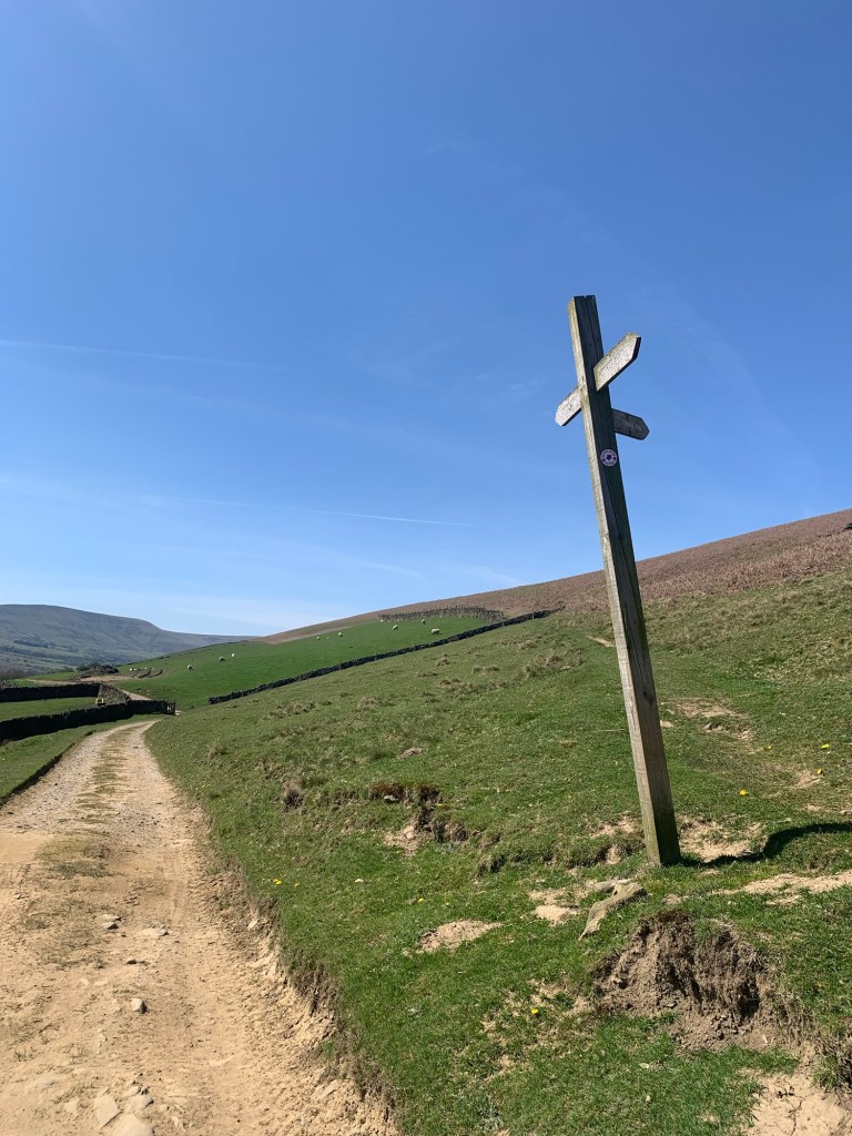
It’s soon a path rather than a track and as we arrive in a field with a junction of ways we bear right uphill and then right again, having joined one of the other routes up Win Hill, from Twitchell Farm.
As we’re walking up, a guy passes us running down towards the farm and as he’s dressed in walking gear rather than running kit, I surmise that he is probably attempting the Edale Skyline Challenge Walk and is on his way to Lose Hill.
If so he’s got a nice day for it.
Of course as if it wasn’t punishing enough to cover the 21 miles of rough terrain of this classic Peak District challenge at walking pace, there is an annual fell race along the route, run in memory of Don Morrison and with a course record of a mere couple of hours. Mind boggling how fit some people are.
Back to reality for us lesser mortals, and it’s a steeper climb now for the next kilometre but nothing too strenuous ( at our pace) and with ever widening views rewarding each and every step.
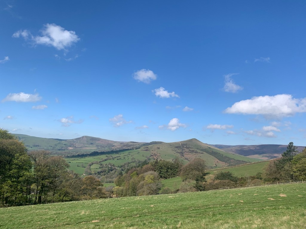
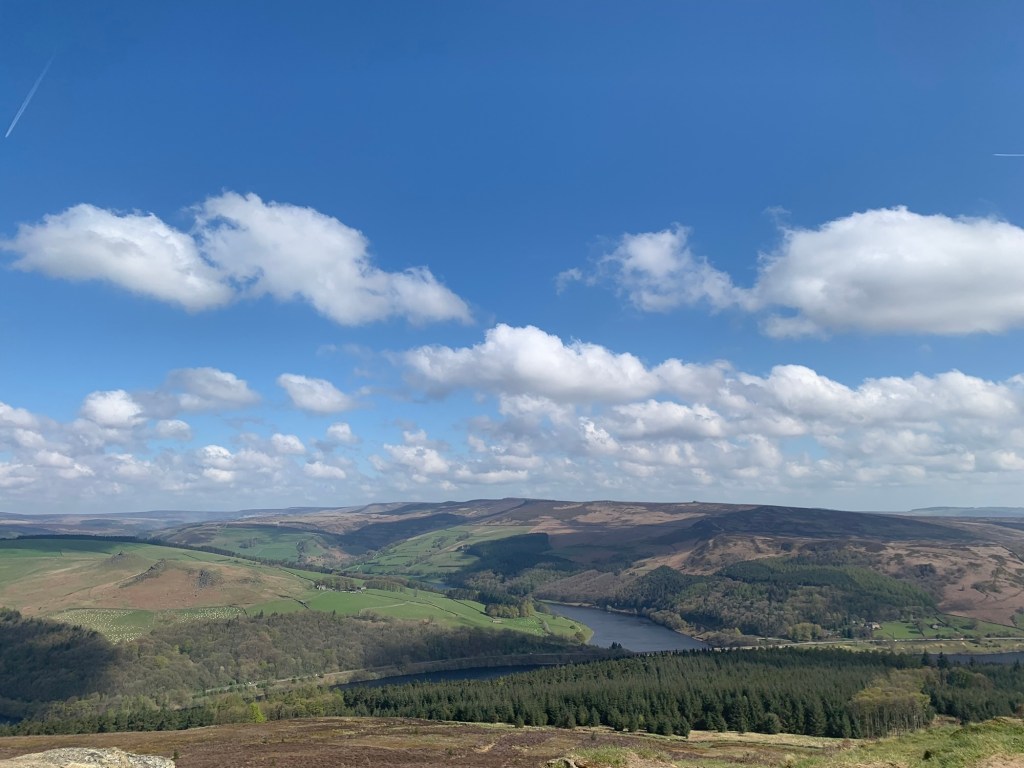
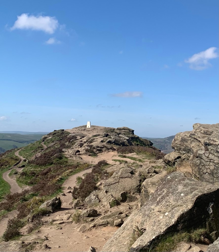
The summit of Win Hill is like a proper mountain top in miniature
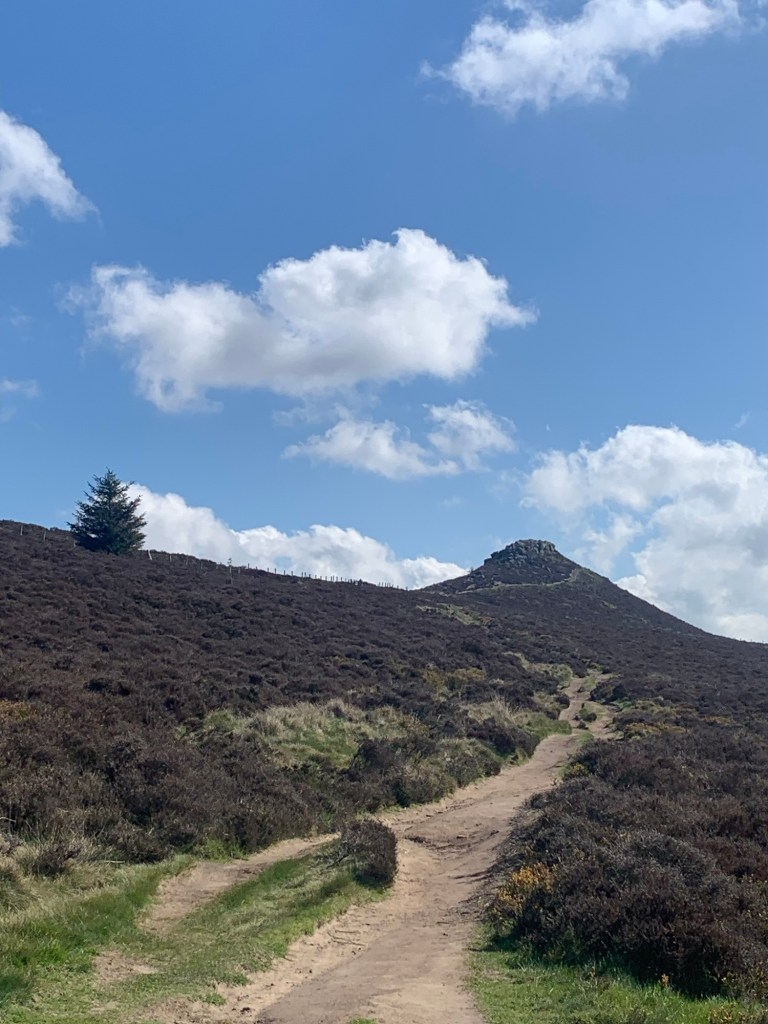
and no matter how often you approach it from this side, nothing can prepare you for the absolutely breathtaking views all around as you reach the trig point.
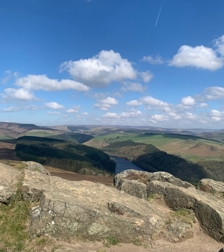
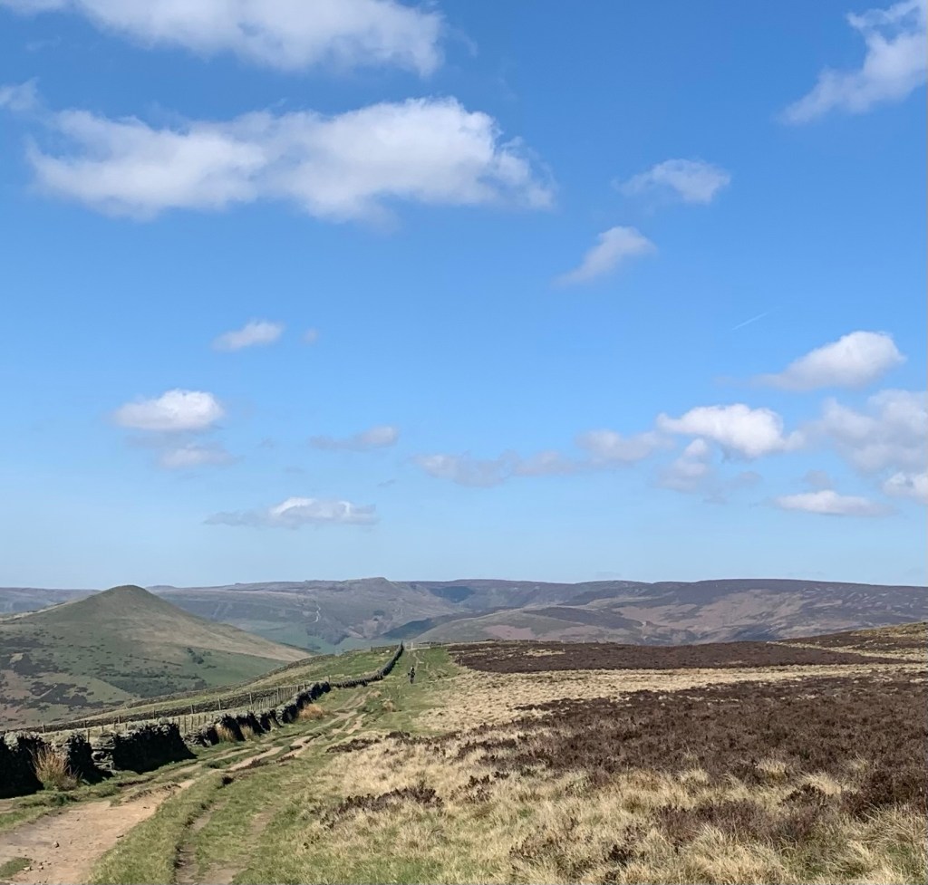
Having duly appreciated the magnificence of the Peak District we walk back along the ridge
to the green sign we passed on the way up and this time we continue straight on keeping the height, along a well made track. We have great views ahead towards the other end of the skyline route and to our left the beautifully shaped Lose Hill.
If you are interested to read the totally fabricated tale of Edwin and Cynegils respectively winning and losing a battle around here in the seventh century just click on the link…. But there are no historical records to back up this story.
The round-backed ridge is slightly descending and delightfully easy walking and we soon arrive at Hope Cross ( which is not a cross) apparently an 18th century way marker that possibly replaced an earlier version ( which might have been a cross).
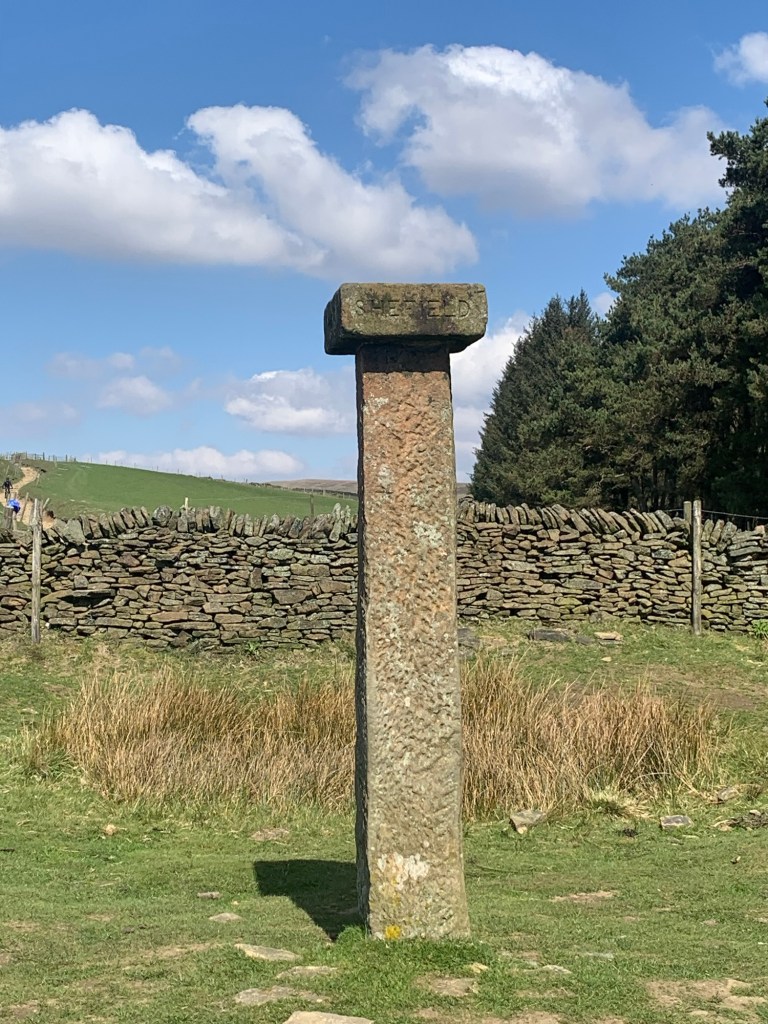
There is a junction of paths here including the one that comes up from the Woodlands Valley ( Snake Road) and crosses over to drop down to Brough. This was long thought to have had Roman origins, but that is now disputed. It does seem likely that it was the continuation of a medieval track known as Doctor’s Gate which once stretched from Glossop to Hope, way before the Snake Road was ever thought of, the doctor in question also being a vicar of Glossop who helped finance the project.
We continue straight on through a gate and then a few hundred metres further, at the next junction of tracks, we turn left.
The path drops down steeply into Jagger’s Clough ( a Jagger was a pack horse drover) and in today’s dry and sunny conditions it’s easy to ford the stream that crosses the path here.
The path winds back up the other side of the Clough and then continues to contour along the side of the Edale valley.
At a finger post there’s a choice between taking a higher level route by way of Rowland Cote Youth Hostel or the lower path by way of Lady Booth.
Either way works as the paths join up again later before arriving at Grindsbrook Booth, the main village of Edale.
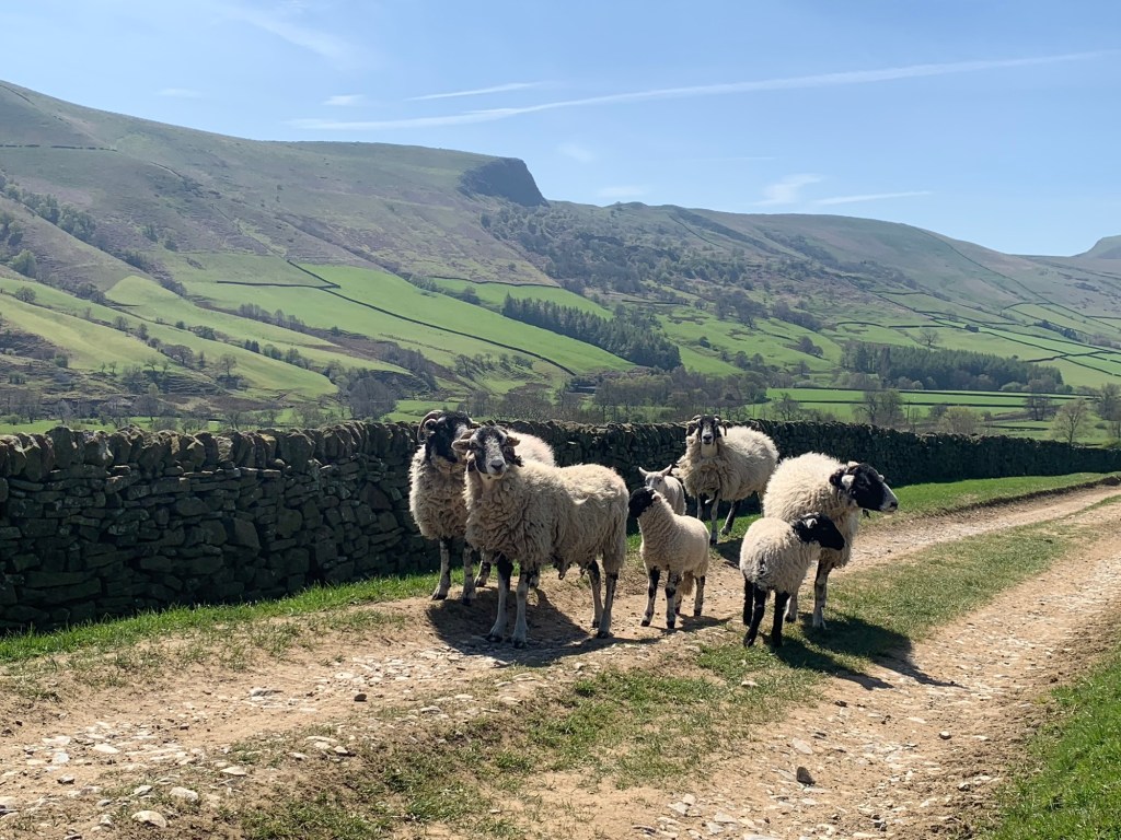
We take the lower path and share our route with a family of sheep
before stepping into a magical hollow way
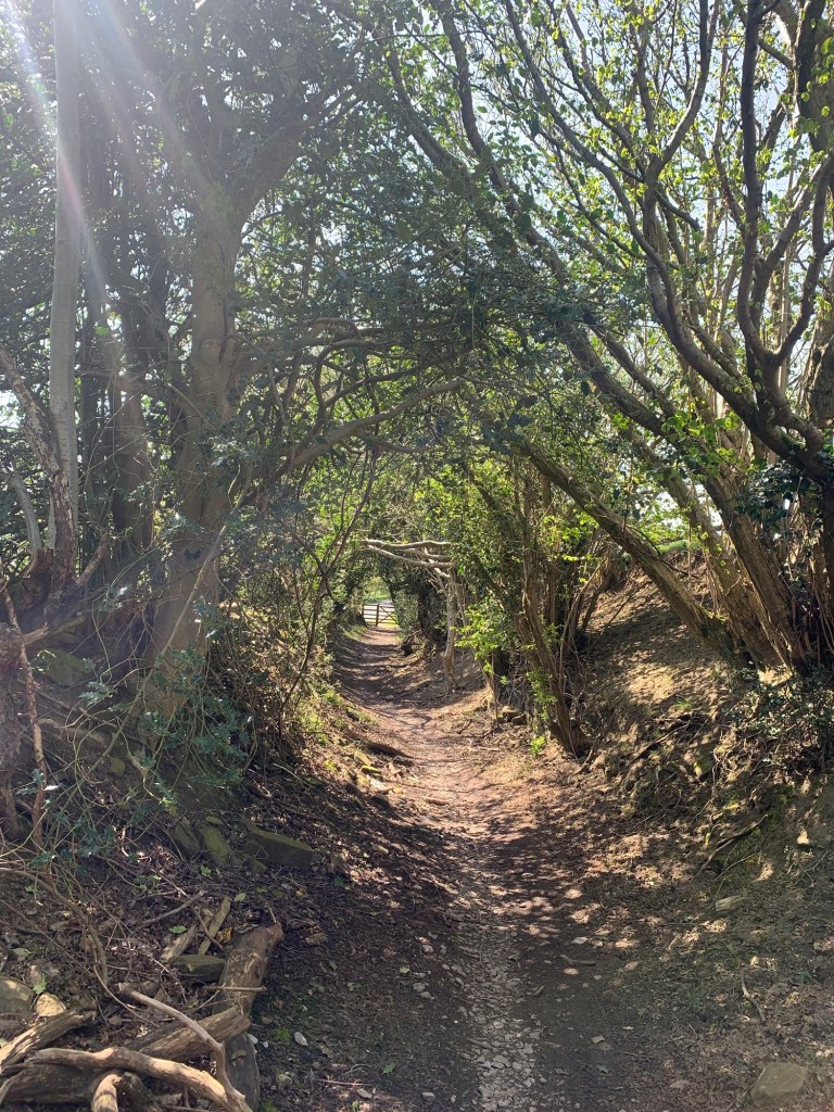
which takes us down briefly along the road in the valley bottom before we rejoin the path just past the farm buildings of Lady Booth.
For more details on the “Booths” of Edale see our E For Edale post where we also walked this part of the path but in the opposite direction.
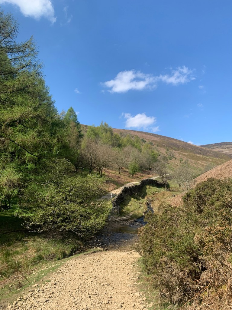
Just before we emerge at The Nag’s Head it seems very fitting on a day of Jaggers and old trackways, that we finish today’s walk by crossing over the quaintest little pack horse bridge you ever saw.
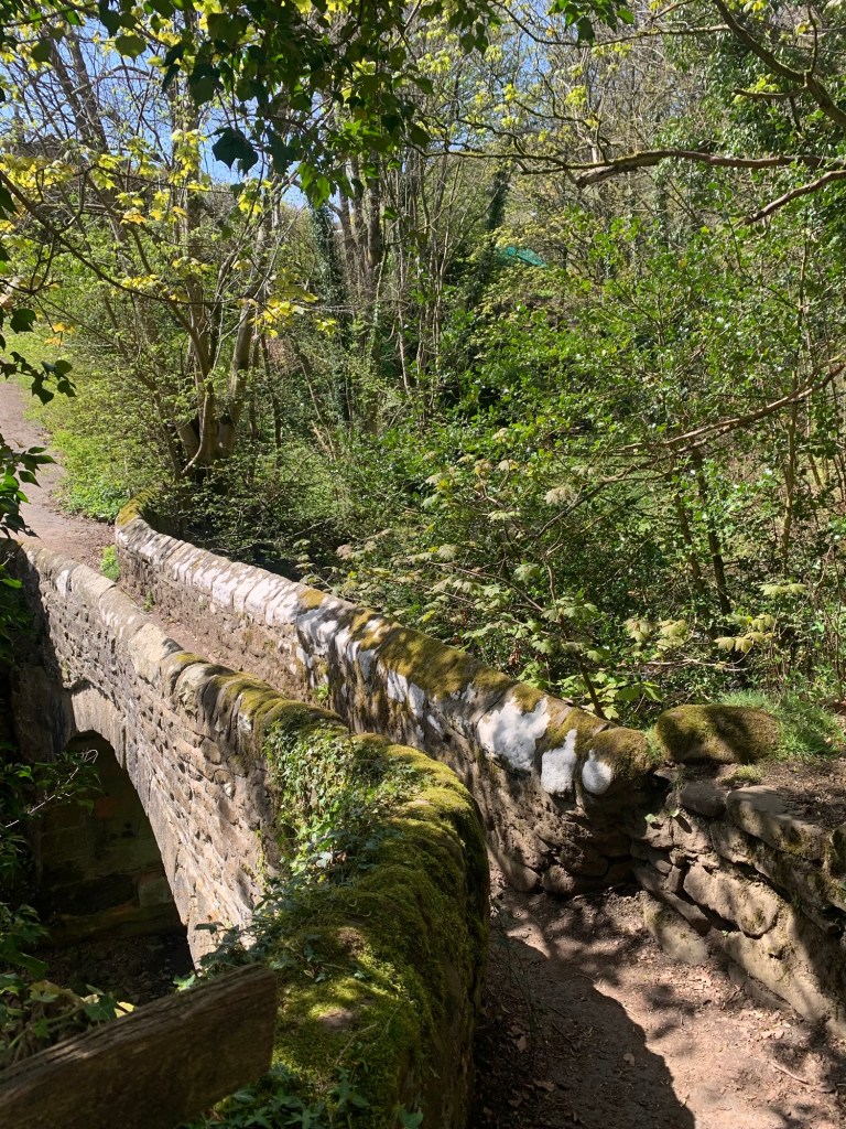
Apparently it has the claim to fame of being the narrowest packhorse bridge in Britain.
We are now walking past the school, the church, the national park centre etc heading for the Penny Pot Cafe and an early train home.
With more time we would have continued as shown on the footpath map ( see link at the end of the post) up the other side of the valley to Hollinscross at which point it would be possible to drop down to Castleton for the 272 or for more of a challenge, having gained the height of Hollinscross turn left for a bit more elevation onto Back Tor and Lose Hill before descending to Hope and the option of either bus or train back home.
Transport
272 Bus or Hope Valley train to Hope Station.
272 Bus back from Castleton or Hope, or train from either Edale or Hope.
Pubs/Cafes
The Nags Head or The Ramblers at Edale
Penny Pot cafe Edale.
Numerous cafes and pubs in Castleton and Hope
How far?
Around 15-25k depending on options taken
Route Synopsis
Hope Station, Win Hill, Win Hill Ridge- Jaggers Clough- Lady Booth- Ollerbrook Booth- Grindsbrook Booth- Hollinscross- Castleton ( or continue along the ridge via Back Tor, Lose Hill and descend to Hope)
Dogs?
Great for well behaved and energetic dogs but as always be extra vigilant for sheep and, at this time of year, for lambs.
Map
OS Dark Peak
https://footpathapp.com/routes/CB3AB8CC-D245-428A-8BB9-91BAD5B2189B?units=metric

Leave a comment